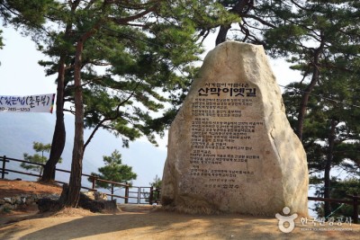
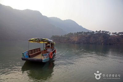
Sanmagi-yetgil Trail (산막이옛길)

stocking
Chungcheongbukdo
0
499
0
0
2023.04.02 20:14
CHUNGCHEONGBUK-DO WEATHER
 > Korea Leisure & Sports http://stockzero.net/bbs/board.php?bo_table=tp_kr_sport&wr_id=123>arget=zh-CN")
|
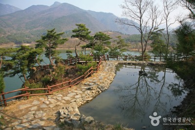
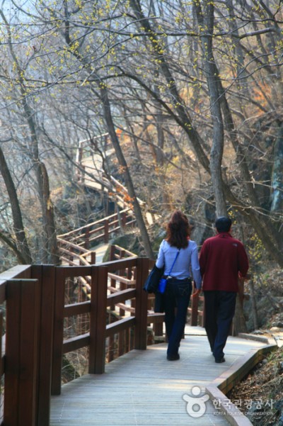
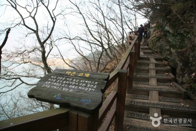
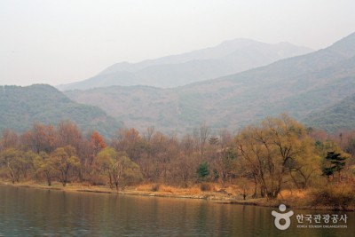
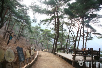
Sanmagi-yetgil 小径是一条连接 Saorang 村和山村 Sanmaki 的 4 公里长的小径,是一条经过山脉、溪流和森林的绝佳步行小径。以环保的方式配备木甲板,以最大限度地减少对环境的破坏并保持自然景观,周围的美景被认为是槐山水坝周围的自然生态系统被保留下来。状态。
|
|||||||
| Open period | Hours of use | ||||||
|---|---|---|---|---|---|---|---|
| Admission fees | Age available for experience | ||||||
| Off day | Inquiry |
• 1330 Travel Hotline: +82-2-1330 (Korean, English, Japanese, Chinese) • For more info: +82-43-832-3527 |
|||||
| Scale | Capacity | ||||||
| Parking facility | Visitors of all ages | Parking Fee | Available | ||||
| Stroller rental | Pets allowed | ||||||
| Credit card | Sauce | KOREA TOURISM ORGANIZATION | |||||
| Address | 88, Sanmagiyet-gil, Goesan-gun, Chungcheongbuk-do | ||||||
STOCKZERO does not store any data regarding current location information. We simply use OpenStreet's source code to show it to our customers.
The location may not be accurate on PC.
By viewing your current location, you are deemed to have understood and agreed to this content.


观光路线:*路线1:4.4公里(约3小时)
露如泉 (900 m) → 登赞峰 (1.1 km) → 半半岛展望台 (900 m) → 天将峰 (2.2 km) → 三马村
* 路线2:2.9公里(约2小时)
露露沙泉 (900 m) → 登禅峰 (1.1 km) → 半半岛展望台 (900 m) → 杜鹃花之丘
露如泉 (900 m) → 登赞峰 (1.1 km) → 半半岛展望台 (900 m) → 天将峰 (2.2 km) → 三马村
* 路线2:2.9公里(约2小时)
露露沙泉 (900 m) → 登禅峰 (1.1 km) → 半半岛展望台 (900 m) → 杜鹃花之丘


